Ryberg
Project Overview
100% ownership

100% ownership
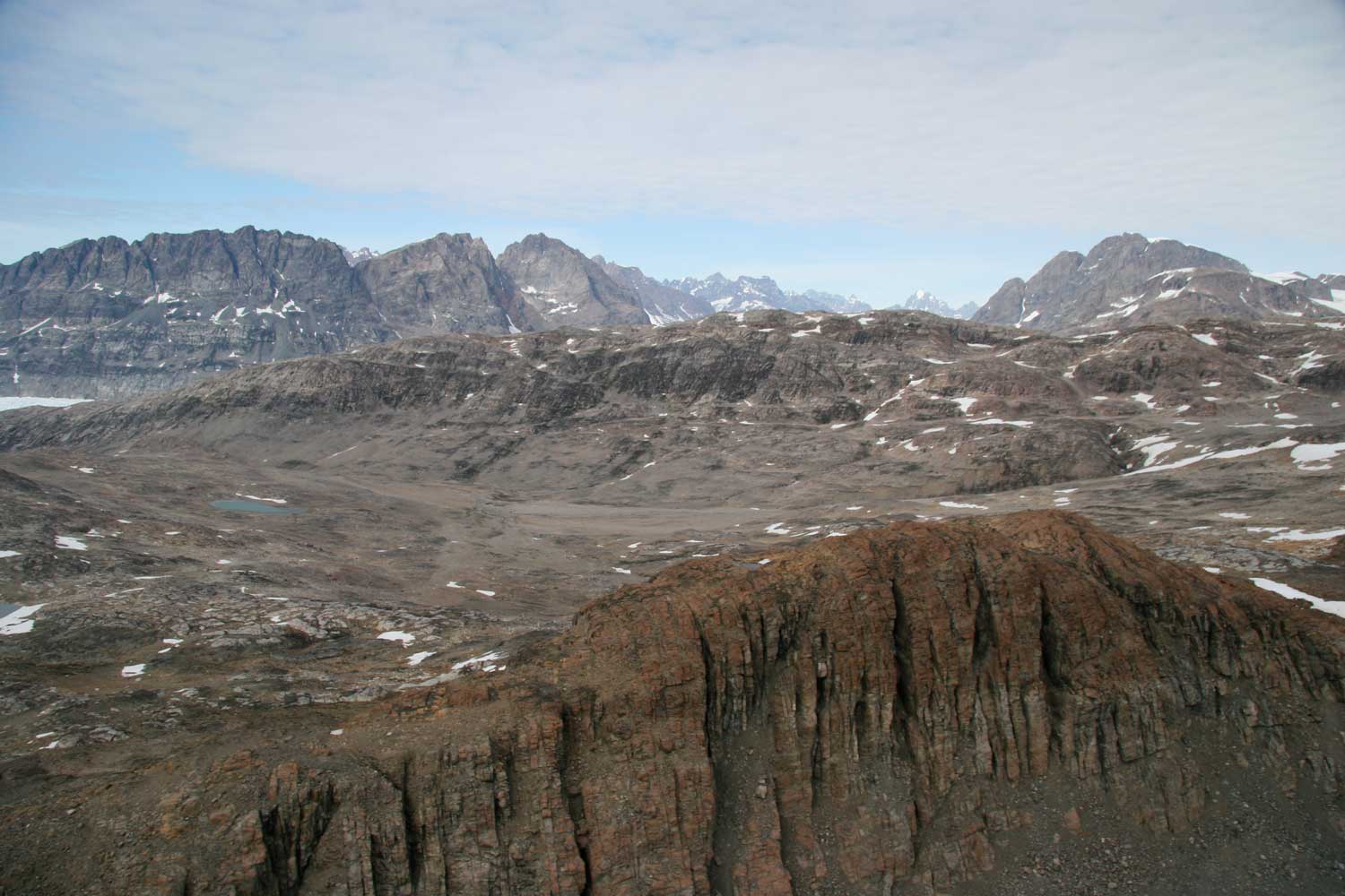
The project area is located within the North Atlantic Igneous Province, a major Tertiary volcanic centre that was the site of one of the largest volcanic events in history, covering an area of 1.3 million km2 (6.6 million km3 in volume) with continental flood basalts. Volcanism is associated with the opening of the North Atlantic, and presence of a mantle plume (what is now the Icelandic hotspot). The project area represents an erosional interface where the flood basalts have been removed, revealing the basement geology beneath. The project area is adjacent to a triple junction (failed rift) and consists of Archaean orthogneiss, Tertiary gabbro/flood basalt, and Cretaceous-Tertiary sediments (rift valley basin). Approximately 70% of the geology within the sedimentary basin has been intruded by Tertiary sills that are feeders to the overlying plateau basalts. There are also feeder dykes and layered mafic intrusions. The presence of ultramafic xenoliths bought to the surface by magma conduits, strongly suggests the presence of a large ultramafic body at depth.
Magmatic sulphides have been seen throughout the licence area, but most activities to date have focussed on the Miki and Togeda Dykes, linear intrusions that combined extend for >50 km and have sulphide mineralisation along their margins. The sulphides are globular/disseminated (up to 20 cm in diameter) and grab samples taken from the surface grade up to 2.2% copper, 3.3 g/t palladium and 0.2 g/t gold. Sulphur isotope analysis on the Miki Dyke indicate that the intrusion underwent sulphur saturation after assimilating abundant pyrite from calcareous pyritic black shale within the sedimentary basin. Regional sediment/stream sampling within the licence area has yielded multiple samples that are anomalous for chromium, nickel, copper and cobalt.

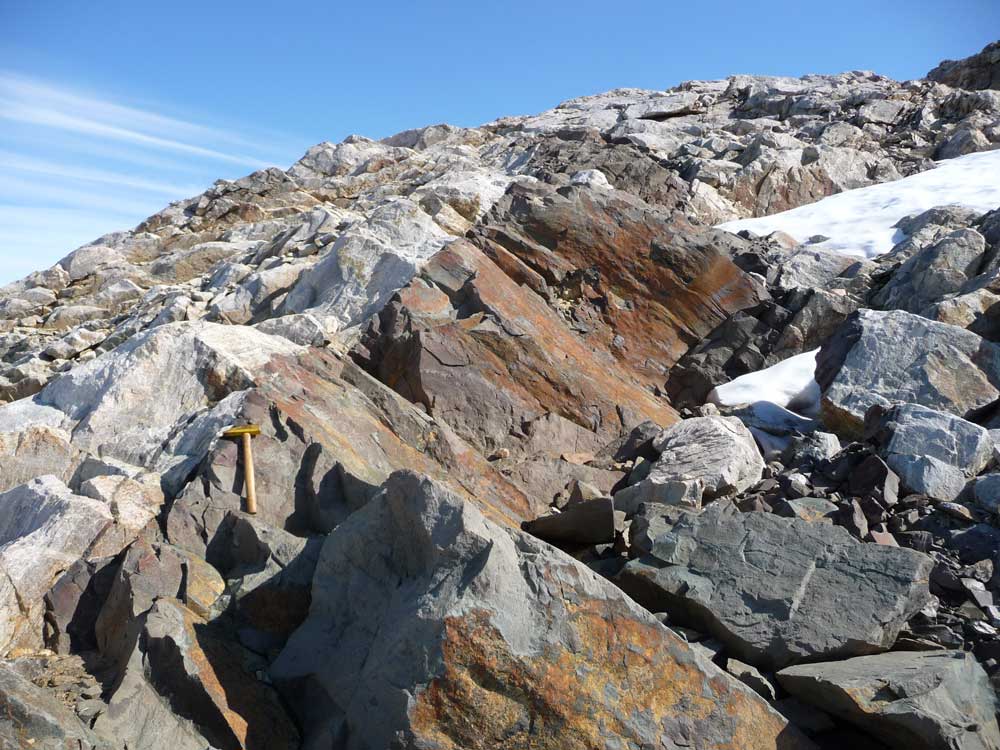
Samples collected by the Company grade up to 2.2% Cu, 0.8% Ni, 0.1% Co, 3.3g/t Pd 0.2g/t Au
Diamond Drilling Conducted in 2021, significant intercepts include:
Geophysical Surveys
Geophysical Survey
High-resolution hyperspectral data was acquired in 2020
Access to site is via aircraft on an existing airstrip located 2 km from the licence area, or ship. Internal movements on site are via helicopter.

Copyright © 2024 Conico Ltd. All rights reserved. Powered by RM Capital | Cloud Cartel